Eugene to
Baker City, OR |
||
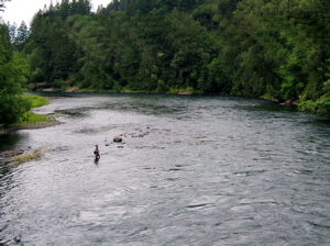 |
I left Eugene Friday morning, July 2nd, crossed the Willamette River for the last time, and picked up McKenzie View Drive which follows the McKenzie River. The road climbed steadily, but not too steeply. Six hours and 65 miles later, I reached the tiny town of McKenzie Bridge, at the foot of the McKenzie Pass Highway. I set up camp at the U.S. Forest Service's McKenzie Bridge Campground, a beautiful but primitive site right on the river- pit toilets, no showers, water from a hand pump. I heated some water, and used my shower bag for the first time. It worked passably well. |
|
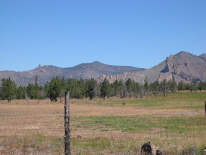
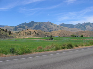
| The McKenzie River near McKenzie Bridge. | ||
|
Sitting there, I experienced loneliness pangs that lasted longer than usual. Normally for me, they are about as pleasant, and last about as long, as "brain freeze". These hung on for a while. I turned on my radio and found a Eugene Classical music station, and cooked dinner- canned chili, rice, and some frozen broccoli. I didn't feel hungry, but I forced myself to eat. (I know it's hard to believe that I would ever have to force myself to eat!) As the food disappeared, so did the loneliness. Saturday morning, I ate a quick breakfast of peanut butter and jelly on a pita, and packed my stuff. It still takes me about an hour and a half to eat and pack. I've seen couples do it in what seemed like half an hour, but it sure takes longer by myself. Then, I started the 23 mile, 4000 vertical ft. climb to McKenzie Pass. |
 |
|
 |
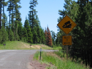
Five miles into the climb, a Ranger was turning traffic around. The road had opened to traffic just the day before. (It's typically closed by snow until around the Fourth of July.) A Wal-Mart semi had attempted the pass on the first day it was open, despite numerous large "NO TRUCK" signs, and lost it on one of the switchbacks on the way down. They were in the process of towing him out of the ditch, and the road was closed. After a minimal amount of pleading, the Ranger let me through, with a warning to watch and listen for heavy equipment coming down the road at me. |
|
| |
||
|
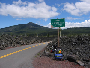
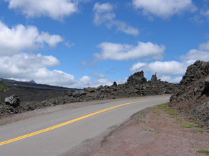
I got past the wreck, which had already been extricated from the ditch, and continued up the climb. It was almost a pleasure to climb with no traffic. The road is ridiculously steep and winding, with no shoulders. I got to the 4,000 ft. mark (noted by a sign) before the traffic started to flow again. Up, up, up. Five hours after leaving the campground, I entered a surreal landscape. Lava all around. It looked like it was dumped there yesterday! In fact, I stopped to touch it to see if it was still warm. (It wasn't- according to the U. S. Geological Survey, the lava is 1500 years old.) Half an hour later, I reached the top. |
|
|
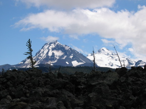 |
The Dee Wright Observatory sits on the summit. Built in the 1930's out of lava and rock by FDR's Civilian Conservation Corps. (a depression era public works program), the observatory offers an amazing view in all directions from its roof. On its lower level (still perched well up there), small windows in the structure face each visible peak, with the peak's name and distance away on a plaque set into the lava just below the window. |
|
The Sisters from the observatory. |
||
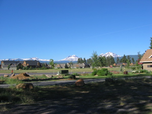
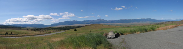
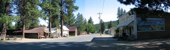
The descent from the pass into the town of Sisters was a bit disappointing. I didn't have to touch the brakes, and never broke 40 mph. My Bike Friday descends like it's on rails! Sisters (pop. 1080) sits in Central Oregon's high desert, at 3,000 ft. above sea level. It's a growing resort town, with strict zoning laws to maintain it's "Old West" flavor. |
 |
|
| |
||
 |
I camped in the city park, a nice quiet spot with no showers (I used my shower bag again), and went back into town for dinner at the Depot Café. It was good enough that I went back there for breakfast on Sunday morning, July 4th, before heading out of town. |
|
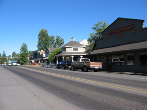
Downtown Sisters |
||
I had a leisurely, flat Independence Day ride, with perfect weather. (Actually, the weather has been just about perfect since I started.) As I rode, I couldn't help but think about Justin Linden, and all those who lost their lives in the line of duty. I feel fortunate to be able to personally witness the beauty of the land and its people, and to experience the boundless freedom that all Americans enjoy, thanks to people who served from the Revolutionary War to the current Iraqi campaign, like Justin. |
 |
|
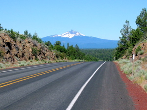
Looking back at Mount Washington. |
||
|
I also thought about Amanda, as I frequently do while I ride. I am privileged to be helping her to learn to do the everyday things that we do without thinking, every day. The highlight of the day's ride was the O'Niel Highway through the Crooked River Valley. The road was a little rough in spots, but there was very little traffic, and the geological formations in the valley were spectacular. |
|
The view
along the Crooked River. |
||
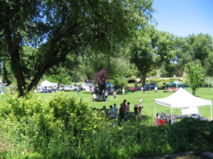
I reached Prineville, a metropolis of almost 7400 people, by lunchtime. The town was having its annual Fourth of July celebration, and it looked like the whole county turned out to enjoy it! The city park was full of people checking out the various booths, listening to local musicians, and just enjoying the fine weather. In the morning, there had been a quadrathalon of some sort, involving a large pool of water that the Prineville Fire Department had set up, and what looked like a steeplechase race. Unfortunately, I was too late to see it. Maybe I'll be back (and on time!). |
 |
|
 |
Soon after leaving Prineville, I reached Ochoco Lake. As I rode along its shore, I was repeatedly buzzed by a Red-winged Blackbird. For some reason, he was really pissed! I stopped at a small grocery store on the lake to pick up some supplies for dinner. When I got back out to my bike, I was attacked by a ferocious barn swallow, under whose nest I had parked. Boy, was he pissed! |
|
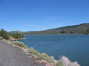
Ochoco
Lake |
||
I set up camp in the Ochoco Lake County Park, about 8 miles past Prineville. The campground (with showers!) was right on the lake, and had a nice quiet out-of-the-way hiker/biker section. And, as the only biker in the campground that night, I had the area all to myself! I spent some time chatting with the camp hosts, Wally and Fosteen Howard, an extremely pleasant retired couple in their 70's. I cooked some Dinty Moore beef stew for dinner (yum!), and got to bed early, even before sunset, but not before being scolded by a couple of chipmunks. Maybe they were pissed because I didn't share my Dinty Moore with them. Generally, I get along better with animals than people. But not today!
|
 |
|
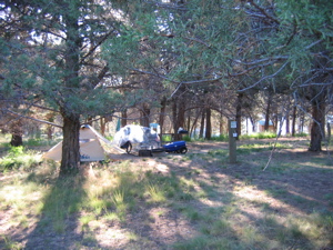
Camp at
Ochoco Lake County Park. |
||
 |
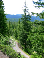
The next morning started with a climb up to Ochoco Pass. The climb was gradual, and I reached the top so fast I surprised myself! The ride down the hill was a blast, and I pulled into the town of Mitchell just before noon, and had lunch at the Bridge Café (not great). It was too early to quit, and Mitchell didn't seem like a very pleasant spot to spend the night, anyway. So I pressed on. |
|
wooHOO!! |
||
From Mitchell, the road climbed seven miles to Keyes Creek Pass. It was a killer climb! But about halfway up, I started to notice painted messages on the roadway shoulder- messages obviously left for previous cyclists. |
 |
|
Long
and winding climb. |
||
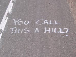 |
They were great! And a huge help. I kept laughing every time a came upon a new message or picture. And they got me up that hill! | |
| When I stopped to rest, which was fairly often, the view behind me was fantastic, but the view ahead was always more hill. | 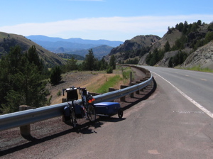 |
|
Keyes
Creek climb with messages. |
||
 |
But with the encouragement in the road, I made it to the top. By the time I got there, it was getting late, and I had 30 miles to go till the next place where I could spend the night. So I started pushing it pretty hard down the other side. |
|
The Top! |
||
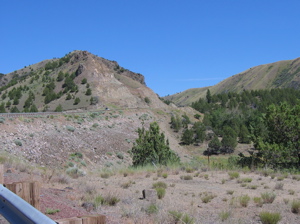
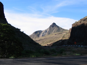
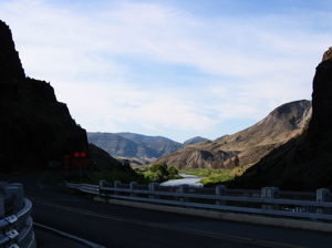
I wasn't prepared for the scenery. I have seen some beautiful country so far, but this took the cake! As I dropped into Picture Gorge in the John Day National Monument, every time I went around a bend, the new view would make me gasp. My shadow was lengthening rapidly, but I kept stopping to take pictures when I could. Many of the views I just kept for myself. A camera, in my hands, couldn't do them justice, anyway. |
 |
|
A butte
in the road. |
||
 |
This place should be on everyone's "Do Not Miss" list. I could have spent weeks going down the gorge, and not grown tired of the views. The area is called Picture Gorge because it has many Pictographs painted on the rocks centuries ago by Native Americans. The John Day Fossil Beds National Monument Visitor Center had closed for the day when I went by. I guess I'll have to come back here, too- on time, of course. |
|
Picture
Gorge |
||
I got to the town of Dayville very late in the day. There was a family barbecue going on in the town park. I looked for a campground, but didn't see anything inviting. I opened my Adventure Cycling TransAmerica Trail map, and read that the Dayville Presbyterian Church takes in bikers. I headed uphill to find it. When I got there, I saw the most awesome sight yet. |
 |
|
The
John Day River in Picture Gorge. |
||
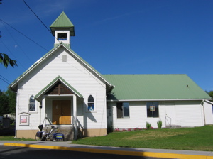 |
It was a sign on the church door that said, "Welcome Bikers! This is a place of rest for the road weary biker. The doors are open to you." And they were! The sign directed me to check in with Claudean, who lives just behind the church. She invited me into her house, and introduced my to her granddaughter, Shelby, and her dog, who licked my face, arms and legs until I laughed and begged him for mercy. Shelby took a basket of towels over to the church, and gave me the grand tour. Claudean joined us at few minutes later. Once they made sure I felt at home, they left me to myself. The shower felt great! |
|
The Dayville
Presbyterian Church |
||
The church kitchen was stocked for bikers. There was a computer for internet access, and two logbooks with bikers' entries back to 2002. I found a week-old entry from Frans and Bonnie from Upstate NY, wishing me and Chris from Denver "good luck"! Also in the log were the OCSJ Four, Ora Sue, Fran, et al. I added my entry to the book, and left early the next morning, feeling refreshed, and thankful for the hospitality of the community towards complete strangers. |
 |
|
In
the high desert, if it ain 't watered, its brown! |
||
 |
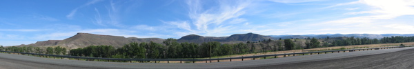
55 miles later (on a gradual upgrade), I was in Prairie City, where I camped in Depot Park. The park surrounded an old railroad depot, which has been converted into a museum. And, for the third night in a row, real showers! (though these cost a quarter for about 5 minutes.) After my shower, I went into town and had dinner at the Branding Iron restaurant- $9.95 for the evening's special, a New York Strip Steak, red potatoes, soup, and salad! Unfortunately, the restaurant was planning to close the following week, due to a lack of business. |
|
Display at
Strawberry Range overlook. |
||
Wednesday morning, I stopped in town for breakfast at the diner, across the street from the Branding Iron. The place was full of local people. I ordered a regular stack of pancakes, and a side of hash browns. I heard the cook call out from the kitchen, "Is he a biker? I hope he's hungry." When my plate came out, I saw what he meant. On it were three of the biggest pancakes I've ever seen! I could only eat half of them. Perhaps the town is too small to support the diner and the Branding Iron (along with another small restaurant down the street that seemed successful), no matter how good and cheap the dinner specials are. |
 |
|
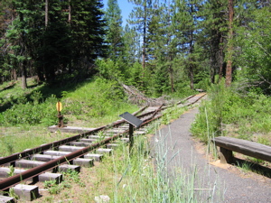
Sumpter
Valley Railway switchback. |
||
 |
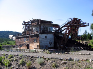
Stuffed to the gills, I headed off on the last leg of this section of my route, 75 miles over three passes to Baker City. It was a beautiful, but windy ride. I stopped to view several sights, including a rebuilt section of the Sumpter Valley Railway, with a restored switchback on Dixie Pass. In Austin, little more than a crossroads, I had an excellent buffalo burger at the Austin House Café. I went a few miles out of my way to see the town of Sumpter and its old partially restored gold mining dredge. The Sumpter Valley was littered with rock piles that were actually leftover "tailings" from the operation of the dredges, three of which worked the Sumpter Valley from 1913 to 1954. |
|
Dredge tailings
in the Sumpter Valley. |
||
It was getting late as I headed towards Baker City, and when I rounded the last corner with ten miles to go, I turned directly into the teeth of a thirty mph wind! I struggled to maintain 10 mph on the flat ground for about five miles, and was getting exhausted. Then, I heard voices behind me, and a group of about ten local cyclists pulled alongside. One of the group told me their club was called "Baker City Velo". They offered the perfect wind break, and pulled me into town at 17mph! It was the last of many miracles between Eugene and Baker City. |
 |
|
The Sumpter
Dredge |
||
 |
||
The "Rattlesnake"
Formation over the John Day River Valley |
||
 |
||
The Strawberry
Range |
||
 |
||
Sumpter |
||
Next Dispatch: Baker City to Missoula |
||