|
Missoula to West Yellowstone |
||
|
||
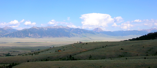
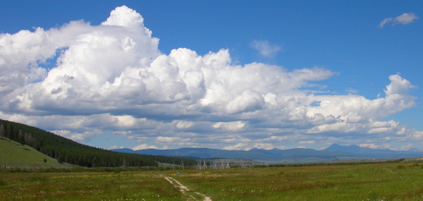
| The Bitterroot Valley | ||
|
On the way out of Missoula on Monday, July 19th, I stopped at Adventure Cycling again to pick up a new handlebar bag. I thought I might avoid future disasters (like dropping the camera again) if my bar bag was better organized. I had lunch with some of the people from the Adventure Cycling group doing the TransAm east to west. I met them on Friday, just before they rented a car and drove up to Glacier National Park for the weekend. They were leaving Missoula on Tuesday, heading for Lolo Pass. We exchanged recommendations, and they told me all about Glacier. (They didn't see any bears, they were happy to report.) I was almost out of town when a thunderstorm came through, so I ducked into a bike shop that I happened to be passing to sit it out. It was over in about 45 minutes, so I got back on the bike. Not quite 20 miles out of Missoula, near the town of Lolo, I came upon Travelers' Rest State Park. Lewis and Clark stopped here on their out-bound journey, and again on their return the following year. Recent archeological digs here discovered evidence of the Corps of Discovery's camp. That makes this spot one of the few with actual evidence of the exact location visited by Lewis and Clark. Montana made the area a state park in 1997. Clark named the camp Traveler's Rest on the out-bound trip, and the captains planned to stop here again on the way home. On their home-bound journey, the captains split the party after leaving here. Lewis went north to follow the Marias River. Clark went south to explore other passes over the Rockies. They met again near where the Yellowstone River meets the Missouri. When I pulled out of the park, I noticed a huge storm approaching. There was a Days Inn Motel right there, and it was getting late in the day anyway, so I checked in, and watched from the safety of my motel room as the storm hurled hail and lightning . The manager of the motel, Bobby Patel, used to work in Philadelphia, at the Dunkin Donuts in 30th St. Station. He told me that the person who owns that Dunkin Donuts also owns 28 other Dunkin Donuts around town. The owner leased a huge Amtrak kitchen on the lower level of the station that had been unused for years, and cooks the doughnuts for all of his locations there. That's why it smells so good when you drive along the river under 30th St. Station on the Schuylkill Expressway late at night! I had to go to Lolo, Montana to learn this. I slept in a bit the next morning. I guess I needed to. I didn't get as much sleep as I would have liked in Missoula. (I was up too late working on the web site!) I fixed a flat before I left my room. It was a slow leak, and I found it by holding the tube underwater in the sink. Just over 40 miles into my day, I came into the town of Hamilton. Here, I spent about an hour and a half on the phone in a U.S. Lacrosse conference call. After the call, I found a nice little restaurant for lunch, then headed on. 20 miles later I was in Darby, and set up camp in a small RV Park. The next morning, after a big breakfast in a Darby restaurant, I headed for Chief Joseph Pass, and my first crossing of the Continental Divide. 20 miles out of Darby, just before beginning the climb, I stopped in the town of Sula to pick up some snacks and water. Sula (population 50) consists of little more than a small resort with cabins and a nice campground. When I came out of the store, Steve from Portland was pulling up! I last saw him just before White Bird Hill. Steve suffered on that climb, too. He passed me while I stayed in Missoula, spent the night just outside of Sula, and was just starting his day. I sat with him while he ate lunch, and we headed up the pass together. It really wasn't too bad of a climb- a gain of just under 3000' in 13 miles. On the way up, a mule deer ran up to the road and stopped just in front of me, staring at me and wiggling one of her long ears. I've seen mule deer almost every day since I started riding, but I've never been able to get a picture of one. This one stood still, watching me for a while. I got out my camera, thinking, "I've got you now, Big Ears!" But, at the sight of my camera, Big Ears took off, and I missed the shot. |
||
|
|
When we were near the top of our climb, a cyclist coming the other way pulled over to talk to us. Dale Hoffman, a retired man from Hawaii, has been cycle touring for years. He gave us many tips on our route ahead. He suggested that we not miss Jackson Hot Springs, 45 miles past Chief Joseph Pass. He explained that it's owned by a German woman named Inga who runs a tight ship, with clean cabins, a wonderful hot spring in a pool attached to the lodge, and a great restaurant. I took some notes about Jackson and his other recommendations, then Dale headed downhill, and Steve and I continued up. We got a picture at the top, and started downhill towards Jackson Hot Springs. Steve is pulling a Burley cargo trailer, and with my new, speedy, trailerless rig, I left him behind, planning to meet him in Wisdom, the town about 15 miles down the road. |
|
| |
||
|
As I rode down the Big Hole Valley towards Wisdom, a skunk wandered out of the pasture to my right, headed for the road. It was clear that the skunk and I were on a collision course. A large RV was headed towards me in the opposite lane, so my only option was to come to a stop in the left portion of my lane, as far away from the skunk as I could get without getting hit by the RV. The skunk realized the predicament when he got to the edge of the road and saw me and the RV, and he came to a stop as well. The RV saw me stop in the middle of the road and didn't know what to do. When he got next to me, he hit the gas, clearing his lane so I could move away from the skunk, who made a U-turn and headed back into the pasture. So, the three travelers went separate ways, each of us spewing our own brand of noxious fumes behind us as a result of the encounter. I pulled into the town of Wisdom around 5:45 PM, and looked for a store so I could grab some snacks and water for the final 18 miles to Jackson. But the only grocery store in town was closed. Two restaurants were open, directly across the street from each other. I went into the one that seemed to have more locals, grabbed a bar stool, and waited for Steve. While I was waiting, a couple pulled up seats next to me. Roger and Connie are also touring cyclists, and saw me pull in. They live in Redmond, in central Oregon. They haven't done a TransAm yet, but one is in their future. They have done a lot of touring, including the Oregon Coast. They were in the area with mountain bikes on their car, and were visiting Big Hole battlefield, about 10 miles back along our route. They highly recommended stopping there. I had a very pleasant dinner with them. Steve joined us about halfway through. Since it was getting dark, and Jackson was still 18 miles away, Steve and I decided to stay in Wisdom for the night, backtrack to the battlefield the next day, and hit Jackson the next night. With the backtracking, it would make for a 40-mile day and leave plenty of time to tour the battlefield. The next morning, I got ahead of Steve on the way to the battlefield. The National Monument and Visitor Center at Big Hole Battlefield are extremely impressive. I spent some time there, watching a film, and touring the battlefield. Here, in 1877, the fleeing non-treaty Nez Perce under Chief Joseph were attacked in their camp at dawn by a ragtag mix of U.S. forces and local volunteers under Colonel John Gibbons, hoping to force the Nez Perce off of their native lands and onto a reservation. Many of the Nez Perce were killed in the attack. Most of the dead were women and children. The Nez Perce warriors rallied and retaliated, holding the U.S. forces in siege for two days before escaping south into the newly-formed Yellowstone National Park. The Nez Perce made their way towards Canada, but were trapped 30 miles short of the border at Bear Paw. There, in an effort to save what remained of his band, Chief Joseph surrendered with his famous words, "I will fight no more, forever." (As my good friend and mentor Ed Schreiber put it, "Interesting words in reference to the world around us today.") However, White Bird refused to surrender at Bear Paw, and escaped with his band to Canada. I think about these people when I climb the passes and hills named for them. When I reach the summits, I don't feel like raising my arms in glory, as if I've conquered the climbs. Instead, It feels to me as if the spirits of the hills have allowed me to pass. Chief Joseph didn't give me too much trouble as I climbed to his pass, just before reaching Big Hole Battlefield. On the other hand, White Bird Hill in Idaho (where the ants passed me) gave me one heck of a time! Like he did at Bear Paw in 1877, White Bird refused to surrender, and I suffered on his hill. Steve got to the battlefield later, and stayed longer than I did, and we agreed to meet at Inga's Jackson Hot Springs Lodge. |
||
 |
||
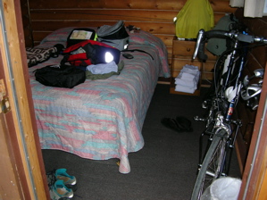
My cabin at Jackson Hot Springs- Just enough room for a bed and my bike! |
I sped to Jackson, covering the 18 slightly uphill miles in a little over an hour, with the aid of a light tailwind. Without the trailer, my speed seems to have increased by 20 - 25%!, and I cruise along in near silence- no rattling trailer wheels- no sounds but a slight whirring of my tires on the pavement, and the birds. When I got to the Jackson Hot Springs Lodge, Inga checked me into a cabin. She seemed stern and competent, but not unfriendly. I half expected to hear horses whinnying when I said, "Good evening Frau Inga." But I didn't. My cabin was cozy and comfortable, and a bargain at less than $30. Dinner in the lodge was excellent- a huge plate of spaghetti and meatballs for $10, including a real salad bar! The hot spring pool attached to the lodge looked inviting, but instead of a dip, I watched Lance win stage 17 of the Tour on the TV in the lodge, sharing the excitement with an Adventure Cycling tour group that also spent the night there. Before I retired for the night, Inga offered me "a glass of varm milk?" "No, thank you, Frau Inga." (whinny!) There was no sign of Steve. |
|
I ate an early breakfast at Jackson Lodge Friday morning. Jimmy Buffett was on the lodge stereo. I've heard a lot of him in Montana. I guess he's popular here because he lived in Montana for a while. In the first 30 miles of my ride, I had two passes to cross. The ride through the last part of the Big Hole Valley was absolutely beautiful! The climb out of the valley over Big Hole Pass wasn't too steep, but a stiff headwind made slow work of it. The headwind continued for the rest of the day. I climbed Badger Pass, and had to pedal hard on the downhill side to maintain 10 m.p.h. against the wind. |
 |
|
| |
||
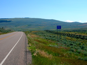
"CHAIN UP AREA AHEAD" means only one thing- a climb. Here, it's Big Hole Pass. |
After 50 miles, I pulled into Dillon, pooped from struggling against the headwind. I found a dinner spot, and checked the map for accommodation information while I ate. The only camping available in town was a KOA Campground, which west-bound riders had told me cost $30, a steep price to pitch a tent. I checked into the Super 8 Motel in town for $40. It's worth $10 not to have to struggle out of a sleeping bag and pull on cold clothes to make my way through the dark for my nightly pee. In a motel, I get a clean shower (usually), and it's an easy trip to the bathroom in the middle of the night. That night, my hotel phone rang. It was Steve, still in Jackson. He'd arrived there late the previous night, after riding through a thunderstorm, then left for Dillon late in the morning. Somewhere along the road not far out of Jackson, the bag containing his tent, sleeping bag, and sleeping pad fell out of his trailer. He retraced his steps, but couldn't find it. He was hoping someone would find it and turn it in, somewhere. Steve ran into some hard luck on his trip, but I admire him. At the age of 20, he's ridden alone from his home in Portland along a self-designed route to meet the TransAm in Redmond, OR; and ridden another 1,000 miles from there. I could never have done that at his age. |
|
On the way out of Dillon on Saturday morning, I had to negotiate about 4 miles of unpaved road, which was under construction. The surface was half dirt, half loose gravel. To make it even more pleasurable, when I was halfway through, a truck came along in the opposite direction, wetting down the road with a deluge of water. It kept the dust down, but turned the dirt into mud. A few miles out of Dillon, I came to Beaverhead Rock. Lewis and Clark stopped here on their way west. Sacagawea, who was their guide at this point, recognized the landmark, and realized the Corps of Discovery had entered her native (Shoshone) territory. From Lewis' journal: "The Indian woman recognized the point of a high plain to our right which she informed us was not very distance from the summer retreat of her nation on a river beyond the mountains which runs to the west. This hill she says her nation calls the Beaver's Head, as it resembles the head of that animal. She assures us that we shall either find her people on this river or on the river immediately west..." |
|
|
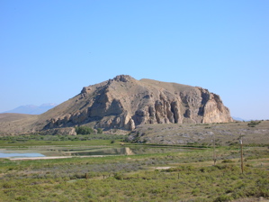
Beaverhead Rock |
Sacagawea may be the most fascinating character in the Lewis and Clark story. Still in her teens, she was brought on the journey as a guide and translator, along with her husband, Toussaint Charbonneau (a French trapper and trader), and their infant son, Jean Baptiste (whom the captains called Pomp). A few years earlier, she had been kidnapped from her Shoshone band by a Hidatsa raiding party, and made a Hidatsa slave. In what was clearly the best trade of his life, Charbonneau, who lived with the Hidatsa, purchased her from them. (He had at least one other Shoshone wife, as well.) The Shoshone were excellent horsemen, and the Corps of Discovery needed horses to cross the mountains. They were counting on Sacagawea to help them find and trade with the Shoshone for horses. When they finally came upon a Shoshone band, led by Chief Cameahwait, they brought Sacagawea into the meeting to translate. In a turn of fate too dramatic for fiction, Sacagawea recognized Cameahwait as her brother, now chief of the very band from which she had been kidnapped! Needless to say, the negotiations went well for the Corps of Discovery. |
|
When we think about Sacagawea as translator, we usually imagine her translating from Shoshone to English, and back. But Sacagawea didn't speak English. She spoke Shoshone (her native tongue), and Hidatsa, the language of the people who kidnapped her. Her husband, Charbonneau, spoke Hidatsa and French, but no English. The captains didn't speak French. When working with the Shoshone, Sacagawea would translate Shoshone into Hidatsa for Charbonneau, who would translate Hidatsa to French for one of the two privates in the Corps who spoke a little French. The privates, in turn, would do their best to translate the French into English for the captains. Given the chain of translation used, it's amazing there were no political disasters. I remember a game we played in grade school, which was designed to teach us to be careful with rumors. The class sat in a circle, and the teacher whispered a simple message into a student's ear. That student passed the message to the next student, and so on around the circle, until the last student recited the message to the group out loud. The message never survived the trip intact. In fact, it was usually changed so much that the final message was completely unrelated to the original. It makes me wonder how Lewis and Clark were able to converse with the Shoshone at all! On November 24th, 1805, when the Corps reached the mouth of the Columbia River at the Pacific Ocean, near present day Astoria, the captains held a vote among the members of the expedition to decide where to spend the winter. (If you remember from my Astoria to Eugene dispatch, Ft. Clatsop was built as a result of the vote.) The votes of Sacagawea and York (Clark's African-American slave) were recorded along with the votes of the captains and all of the members of the Corps of Discovery. Surely this was the first time in the history of the United States that the votes of a woman and a black man were counted equally with the votes of white men!
|
||
|
||
|
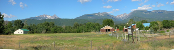
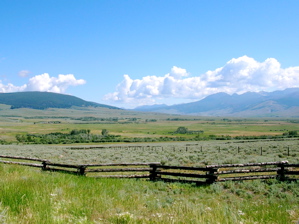
The Madison Valley
|
||
|
|
About 50 miles past Beaverhead Rock, I came to the restored mining towns of Nevada City and Virginia City. These places were too "touristy" for me. Most of the western towns I've passed seemed much more "real", and weren't loaded with tourist-trap shops. I didn't even take a picture here. I climbed another pass after leaving Virginia City, dropped into the Madison River Valley, and after 80 miles on the day, came into Ennis, an authentic western town. I had dinner in a small restaurant, and was joined halfway through by a very pleasant couple from Farmingdale, Maine, who are riding the TransAm in the opposite direction on their recumbent tandem. We did the usual exchange of recommendations and stories, then I found a cheap motel and went to bed, hoping for an early start the next morning. |
|
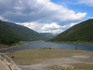
Quake Lake |
||
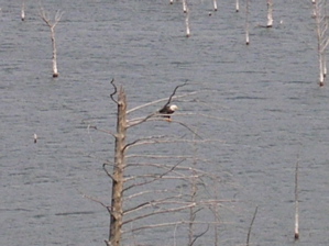
I left Ennis Sunday morning at about 8:00AM, fairly early, for me! The route followed the Madison River, prime fishing territory. Guide-boats and rafts with people fishing from them were going down the river all day as I was riding up. Fighting a headwind and suffering a bit in the heat, I rounded a slight bend and felt the bike swerve under me. My rear tire was flat. I briefly dreamed of changing places with the fishermen. While I was fixing the flat, an auto-tourist from Colorado gave me an especially refreshing cold bottle of water. As soon as I got going again, a shadow crossed the road directly ahead of me, and I looked up just in time to see a Bald Eagle soaring 40 feet over my head, looking down at me. Plus, the wind had shifted, and I was getting a rare push. Woo HOO!! My luck was changing! I'll stick with my bike, thanks. A little while later, I came to Quake Lake. Late in the evening of August 17, 1959, an earthquake knocked part of the mountain here loose, resulting in a landslide and flood, which took the lives of 28 people who were camping in the valley. After a brief stop at the visitor center, I moved on. Riding along just a few minutes later, I saw a Bald Eagle sitting near the top of a drowned tree in the lake. He even sat still long enough for me to snap a photo! I pushed on, reaching the town of West Yellowstone, Montana just before dark. |
|
|
|
||
| Previous Dispatch, "Baker City to Missoula" Dispatch Menu | ||